Subject: Central United States
Period: 1836 (published)
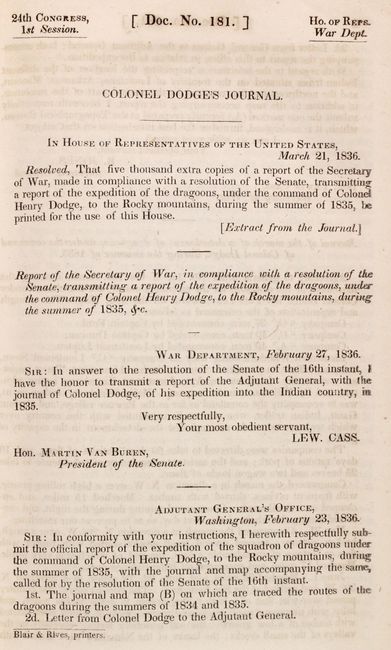
Publication: H.R. Doc. 181, 24th Congress, 1st Session
Color: Hand Color
Size:
5.9 x 9.1 inches
15 x 23.1 cm
Henry Dodge enlisted as a captain in the Missouri State Volunteers in the War of 1812, soon earning the rank of Major General. After the war, Dodge moved to the U.S. Mineral District in Michigan Territory. There, as Colonel of the Michigan Territory militia, he became known for his efforts in protecting locals from attacks from Native Indians, particularly in the 1827 Winnebago War and the 1832 Black Hawk War. Due to his success in these wars, Dodge was appointed Major of a battalion of mounted rangers that became known as the United States Regiment of Dragoons. In his role, Dodge patrolled the Indian frontier from the Red River to the Rocky Mountains. His journal describing his expedition was presented to the House of Representatives in 1836, accompanied by two important maps:
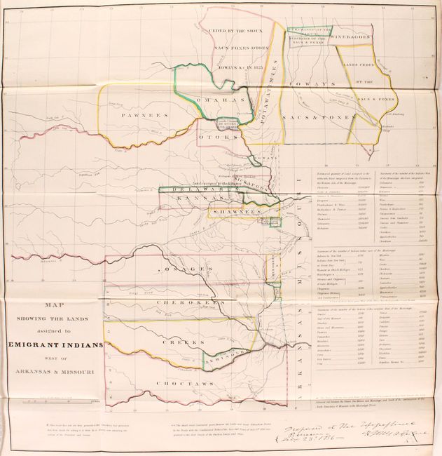
A. Map Showing the Lands Assigned to Emigrant Indians West of Arkansas & Missouri (17.9 x 18.7"). This attractive map covers the region of present day Iowa, Nebraska, Kansas and Oklahoma. The tribal lands are outlined in fine, original hand color. An inset provides tabulations of the numbers of Indians and a listing of estimated acres of land assigned to these Tribes. While it shows the Santa Fe Road, the route of Col. Dodge is not depicted. The map is based on the 1835 map prepared by Lt. Washington Hood and Wheat calls it "an important historical map." It documents an ugly phase of American history during the first half of the 19th century when Indian tribes were forced to migrate to the areas shown. This is the original and rare issue of 1836, not to be confused with the later issue by the ASP Military Affairs.
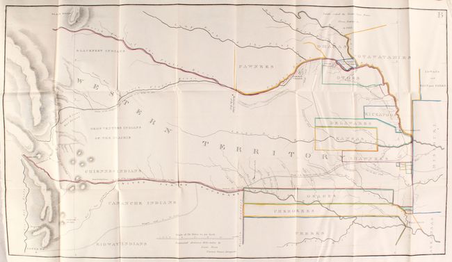
B. [Untitled - Western Territory] (34.7 x 19.5"). This map, attributed to Lt. Steen, details the 1835 expedition of Dragoons under the command of Colonel Henry P. Dodge. It extends from Pike's Peak, Touse (Taos) and Santa Fe in the west and east to Fort Leavenworth. It locates rivers, mountains, Indian reservations, Indian villages, military posts, and the Santa Fe Trail. A landmark map for illustrating land holdings of the Western Indians.
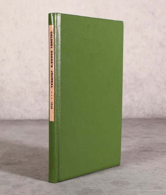
The maps are bound in with the 37-page report . Rebound in green library buckram with paper title label on spine.
References: Wheat (TMW) #418 & #421; Claussen & Friis #127 & #128; Wagner-Camp #63.
Condition: A
The folding maps are clean and bright with just a hint of offsetting. Text is near fine, and the binding has minor wear.