Subject: North America
Period: 1821 (dated)
Publication:
Color: Hand Color
Size:
20.9 x 17.4 inches
53.1 x 44.2 cm
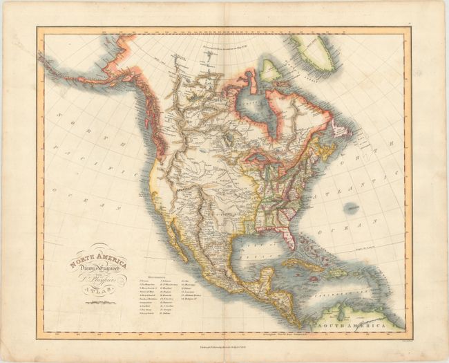
A detailed map of the continent showing the United States confined to east of the Mississippi River with a key at bottom naming 24 states and territories. It shows a large Louisiana Territory extending into New Mexico, indicating the map was drawn prior to the Adams-Onis Treaty of 1819 when the boundary between the United States and Mexico was established. Further west is an elaborate network of mountains extending from Lake Winnipeg to the Rocky Mountains, with an east-west range extending through the Great Basin. The region of present-day California and Oregon is almost entirely void of inland detail. In the Arctic, the discoveries of MacKenzie and Hearne are noted, and Alaska's outline is relatively accurate. Engraved by Samuel Neele and published by Macredie Skelty in Edinburgh.
References:
Condition: B+
There is faint color offsetting and centerfold separations at top and bottom that have been closed on verso with archival material.