Subject: Pacific Ocean
Period: 1860-1901 (circa)
Publication:
Color:
This lot contains two maps focused on colonial ownership in the Pacific:
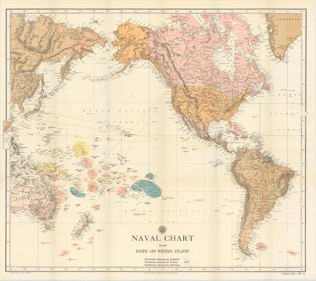
A. Naval Chart of the Pacific and Western Atlantic, by U.S. Navy Department, circa 1901, printed color (26.0 x 22.3"). This map shows the territories claimed by Germany, France and England not only in the Pacific, but also the Caribbean and South America. Dates of discovery or protectorate status are shown. The map demonstrates the strategic importance of the Hawaiian Islands in relation to the territories claimed by the European countries. Condition: Issued folding on a bright sheet. (A)
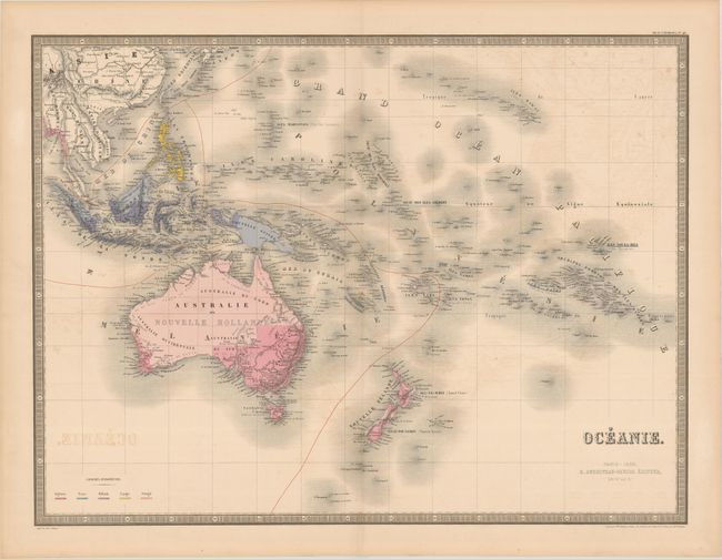
B. Oceanie, by E. Andriveau-Goujon, from Atlas Universel, dated 1860, hand color (24.3 x 18.3"). This handsome map includes Indochina, Indonesia, the Philippines, Australia, New Zealand, Hawaii, French Polynesia, and several other Pacific islands. English, French, Dutch, Spanish, and Portuguese colonies are indicated by color with a key at bottom left. Printed by Louis Antoine and engraved by Flahaut, Smith, Rousset, and Fontaine. Condition: Light offseting. (B+)
References:
Condition:
See description above.