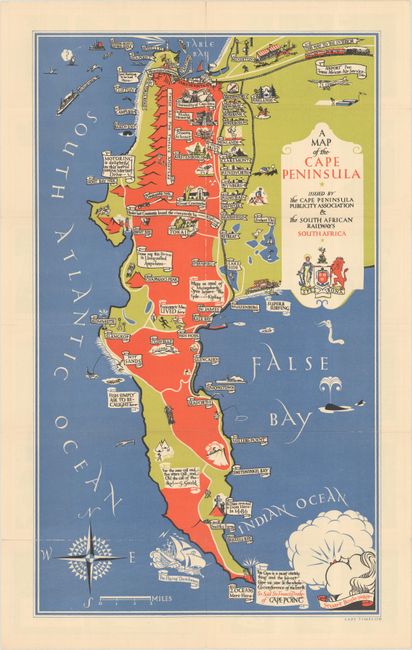
Subject: Cape Peninsula, South Africa
Period: 1936 (dated)
Publication:
Color: Printed Color
Size:
12.6 x 21.3 inches
32 x 54.1 cm
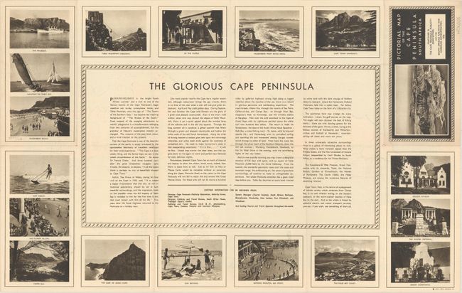
This pictorial map presents a rather idyllic representation of the region and was issued in partnership between the Cape Peninsula Publicity Association and South African Railways. Drawn by Stuart Boyle, the map promotes tourism and commerce with illustrations of surfing, golfing, wineries, fishing, hiking and more filling the map. Features quotations by Kipling and one by Francis Drake stating "This Cape is a most stately thing and the fairest Cape we saw in the whole circumference of the Earth." The map is completed by a windhead, compass rose, and title cartouche. Verso contains related text entitled "The Glorious Cape Peninsula" with numerous photo illustrations.
References:
Condition: A
Issued folding on a bright sheet with a few tiny separations along the vertical fold. A small separation confined to the lower left blank margin has been closed on verso with archival tape.