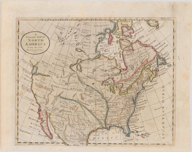
Subject: North America
Period: 1790 (circa)
Publication: Encyclopedia Britannica
Color: Hand Color
Size:
8.6 x 7 inches
21.8 x 17.8 cm
This small map of North America was issued in the first American edition of the Encyclopedia Britannica by Thomas Dobson. This voluminous work, based upon the third English edition, was published in 18 volumes and issued in parts from 1790-97. This map (plate XIV) was included in the first volume and shows the young United States confined to east of the Mississippi River with Louisiana and New Mexico to its west. The Missouri River is partially drawn with a note stating "The Head of this River is Unknown." The northwest portion of the continent is blank, with both a "Western Sea" and River of the West suggesting a possible Northwest Passage via a network of rivers and lakes. The west coast is labeled New Albion with several explorer notations along the coast.
References:
Condition: B+
Minor foxing and soiling.