Catalog Archive
Auction 176, Lot 674

"Negroland and Guinea. With the European Settlements, Explaining What Belongs to England, Holland, Denmark &c.", Moll, Herman

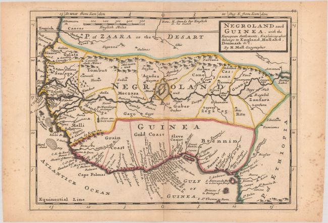
Subject: Western Africa

Period: 1732 (circa)

Publication: Atlas Minor

Color: Hand Color

Size:
10.9 x 8.1 inches
27.7 x 20.6 cm
Download High Resolution Image
(or just click on image to launch the Zoom viewer)

This is one of the few maps to use the term "Negorland." The map extends north to above Cape Blanco and the Tropic of Cancer, and south to below the Gulf of Guinea. The Gold, Slave and Ivory Coasts are located and a notation in present-day Guinea identifies the location of gold mines. The Senegal and Niger are erroneously joined into one river connected by a lake. A very uncommon map.

References: Phillips (Atlases) 585.

Condition: B+

Contemporary outline color with light toning that is a bit more pronounced along the centerfold and marginal foxing.

Estimate: $140 - $170

Sold for: $120

Closed on 2/12/2020

Archived