Subject: Northwestern Africa, Atlantic Islands
Period: 1650 (circa)
Publication: Nouvel Atlas, Vol. V
Color: Hand Color
Size:
21.1 x 16.5 inches
53.6 x 41.9 cm
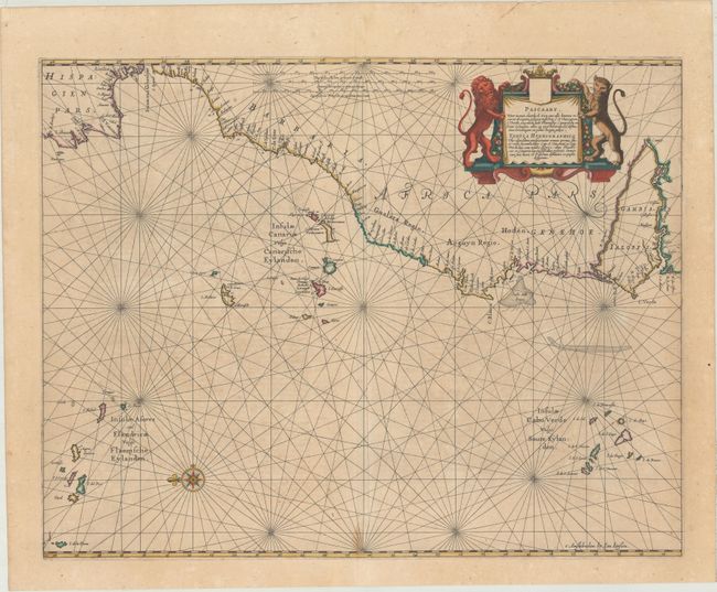
An attractive and uncommon chart covering the northwestern coast of Africa from Gambia to the Strait of Gibraltar along with several Atlantic Islands including the Azores, Canary, and Cape Verde islands. Numerous place names are located along the coast and all islands are identified. North is oriented to the left. Adorned by a decorative title cartouche flanked by a lion and leopard, a compass rose with fleur-de-lis, and rhumb lines in the waters. Title is written in both Dutch and Latin with French text on verso.
This chart was issued in Jansson's Une Parfaicte Description du Monde Maritime ou Hydrographie Generale de Toute la Terre..., considered to be the first true sea atlas. Pilot guides supplemented with charts appeared as early as 1584, but not as a collection and issued in folio size prior to 1650. This sea atlas served as the fifth volume of Jansson's Nouvel Atlas.
References: Van der Krogt (Vol. I) #0150:1.
Condition: B+
Full contemporary color with light scattered foxing and a small stain at the bottom of the centerfold. A 2.5" tear adjacent to the Canary Islands has been professionally repaired on verso.