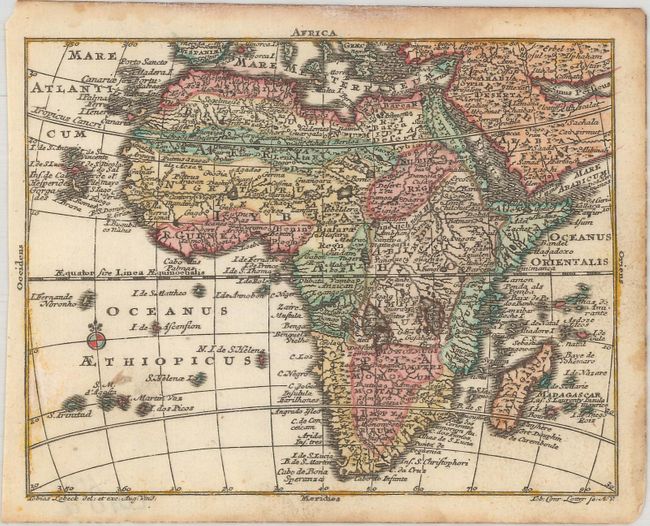
Subject: Africa
Period: 1760 (circa)
Publication: Atlas Geographicus Portatilis
Color: Hand Color
Size:
4.9 x 3.8 inches
12.4 x 9.7 cm
This is a miniature version of Matthias Seutter's map of the continent, which was based largely on Homann's 1715 map. The map is typical of the period with the information in southern Africa being largely fictitious and enormous lakes depicted in central Africa. The Nile is shown originating in the south at lakes Zaire and Zaflan and there are two St. Helena Islands in the Atlantic Ocean. The map is filled with place names that require a magnifying glass to read!
References: King (2nd Ed.) p. 171; Mickwitz & Miekkavaara #134-5.
Condition: A
Full contemporary color with damp stains mostly confined to the blank margins and a small paper flaw in the Atlantic Ocean.