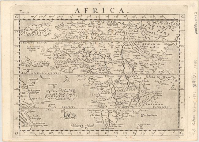
Subject: Africa
Period: 1600 (circa)
Publication: Le Relationi Universali...
Color: Black & White
Size:
9.6 x 6.8 inches
24.4 x 17.3 cm
Early map of the continent in the Italian style with a stipple engraved sea and script style lettering. The map is based on Abraham Ortelius' map of the continent, which is typical of late 16th century cartography with the Nile rising from twin lakes south of the Equator. The coastal names appearing around southern Africa are as originally laid down by Portuguese explorers. As is seen in many maps from this period, Zanzibar is incorrectly located on the west coast. A ferocious sea monster lurks between Africa and the Brazilian coast. The map is filled with city names, although Monomotapa and Vigiti Magna are noticeably missing. The map is believed to have been engraved by Girolami Poro, whose imprint appears in the border at bottom left. This is the third state with "Fac 153" added above map at left, which appeared in the 1600 and 1602 editions of Boter's Le Relationi Universali.
References: Betz #32.3; Norwich #22.
Condition: A
Marginal soiling with remnants of hinge tape on verso.