Subject: Northern Asia
Period: 1662 (circa)
Publication:
Color: Hand Color
Size:
6.4 x 4.9 inches
16.3 x 12.4 cm
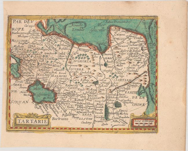
This interesting small map of northern Asia extends to show part of the Black Sea and the western tip of the Americas, separated from Asia by the Strait of Anian. Korea is shown as an island and only part of Novaya Zemlya is delineated. The Caspian Sea is depicted in an odd oval shape extending east-west. The map is filled with place names and the Great Wall of China is prominently shown. This map is a close copy of Pierre Duval's map that was published in Cartes de Geographie Revues et Augmentees in 1657-62, edited by Antoine de Fer.
References:
Condition: B+
A nice impression with full contemporary color that appears to have been partially refreshed. There is an area of light soiling at left and a small hole in the image that has been repaired with old paper on verso.