Catalog Archive
Auction 176, Lot 497

"Les Estats de la Couronne de Pologne", Chiquet, Jacques

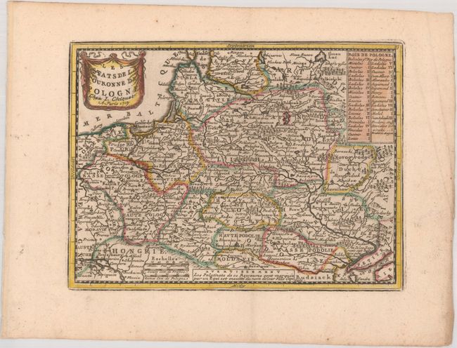
Subject: Eastern Europe, Baltic

Period: 1719 (dated)

Publication: Le Nouveau et Curieux Atlas Geographique et Historique

Color: Hand Color

Size:
8.8 x 6.5 inches
22.4 x 16.5 cm
Download High Resolution Image
(or just click on image to launch the Zoom viewer)

This uncommon small map illustrates the region of Eastern Europe that contains present-day Poland, Lithuania, the Russian enclave of Kaliningrad, Belarus, Moldova and part of the Ukraine. A table at upper right lists the kings of Poland and in the opposite corner is a drape-style title cartouche.

References: Mickwitz & Miekkavaara #43-13; Shirley (BL Atlases) T.MEN-1b.

Condition: A

A nice impression on a watermarked sheet with marginal soiling and creasing.

Estimate: $140 - $170

Sold for: $100

Closed on 2/12/2020

Archived