Subject: Southern Denmark
Period: 1649 (dated)
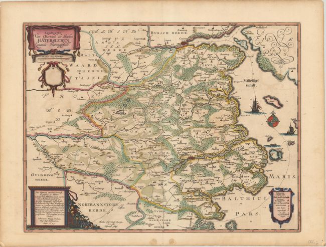
Publication: New Landesbeschreibung ... Schleswich und Holstein...
Color: Hand Color
Size:
21.1 x 15.9 inches
53.6 x 40.4 cm
This uncommon and handsome map of the historical area of Southern Jutland was drawn by cartographer Johannes Mejer (or Meyer). It was published in 1652 in a collection focused on Schleswig and Holstein, with text and additional historical maps by Caspar Danckwerth. The map centers on the historical Baringsyssell region. Political divisions are delineated, and there is nice detail of topography. Numerous towns and cities are named, most notably Haderslev and Kolding. Aroe, Bagoe, and other small islands are identified in the Little Belt in the Baltic, with small illustrations of vessels also filling the water. There are three decorative cartouches: an ornate title and distance scale cartouche with a blank shield at top left; a dedicatory cartouche at bottom left; and a cartouche containing a key at bottom right. Engraved by Matthias and Claus Petersen.
References: Shirley (BL Atlases) T.DANC-1a #8.
Condition: B+
A dark impression with light offsetting. There are two archivally repaired worm holes and a short centerfold separation all confined to the blank margins.