Subject: Cartographic Miscellany, Game, Europe
Period: 1845 (circa)
Publication:
Color: Hand Color
Size:
25.6 x 18.7 inches
65 x 47.5 cm
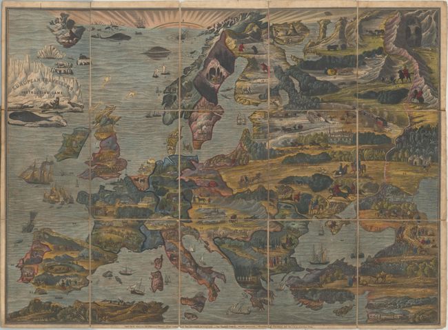
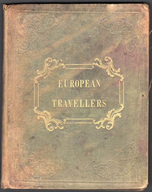
This highly decorative game map leads players through 123 European stops from Mt. Hekla in Iceland east to the Ural Mountains, south to Turkey and Cyprus, and finally back west to England. Surrounding these 123 stops are hundreds of beautiful vignettes symbolizing various European cultures, points of interest, natural resources, and wildlife including a scene by the title of a fierce polar bear attacking a walrus on an iceberg. The map was accompanied by an instructional booklet (not present) with descriptive information to further educate its English audience on each stop. Dissected map laid on original linen. Folds into green cloth boards with gilt title on the front cover (5.4 x 6.8").
Map games were a popular sideline for cartographic publishers from about 1760 onward in England, with John Bowles publishing the earliest geographical game in 1759. John Wallis Sr. and his son Edward began working together as mapsellers and publishers, and by the 1790s, Wallis' business began to focus on map games, at which point he began to dominate the London market for such items.
References:
Condition: B
A colorful example with light dampstains and soiling. Two panels at top are beginning to separate from the linen. Boards are stained and lightly sunned.