Catalog Archive
Auction 176, Lot 380

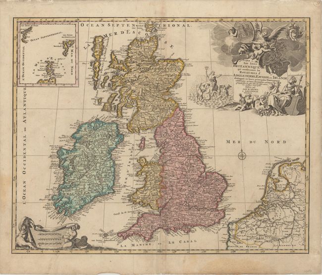
"Les Isles Britanniques qui Contiennent les Royaumes d'Angleterre, Escosse, et Irlande Distingues en Leurs Principales Provinces Subdivisees en Leurs Shireries ou Comte...", Jaillot/Elwe
Subject: Britain

Period: 1792 (dated)

Publication:

Color: Hand Color

Size:
23.3 x 18.6 inches
59.2 x 47.2 cm
Download High Resolution Image
(or just click on image to launch the Zoom viewer)

Jan Elwe's edition of Jaillot's fine map of the British Isles was issued nearly 100 years after it first appears, affirming the quality of the map. The title cartouche is embellished with putti, Neptune, Mercury, and other allegorical figures. A large inset details the Shetland, Faroe, and Orkney islands. This last state of the map is very scarce.

References: Shirley (BI to 1750) Jaillot 4.

Condition: B+

A nice impression on a sheet with two elephant watermarks. There is light soiling, an extraneous crease running parallel to the centerfold, and a couple damp stains that just touch the neatline at left and at bottom.

Estimate: $500 - $650

Unsold

Closed on 2/12/2020

Archived