Subject: Europe
Period: 1845 (dated)
Publication:
Color: Hand Color
Size:
35.2 x 26.3 inches
89.4 x 66.8 cm
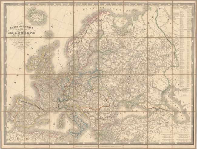
Scarce dissected and linen-backed folding map filled with great detail of the postal routes and railroads throughout Europe. There are interesting political boundaries, with the Austrian Empire encompassing much of central and eastern Europe, the Kingdom of Prussia extending through Germany and much of Poland, and the Balkans forming part of the Ottoman Empire. Two tables at right provide distances between Paris and the capitals of countries throughout Europe and also between Paris and the principal city of each department within France. Keyboard style border. Published by Auguste Logerot. Folds into marble paper slipcase.
References:
Condition: A
Map fine with original paper label on verso. Slipcase damaged with sides torn, but all still there. Brown ink name and date (1845) of original owner below label.