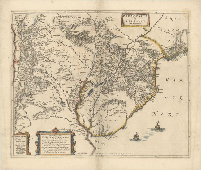
Subject: Central South America, Paraguay
Period: 1690 (circa)
Publication:
Color: Hand Color
Size:
21.4 x 17.6 inches
54.4 x 44.7 cm
Centered on the course of the Rio De La Plata, this map explores parts of Paraguay, Uruguay, Argentina, Chile, and Brazil. Numerous South American cities are depicted, including Sao Paulo, Santos, Cordoba, and Buenos Aires. The map gives an overview of the Jesuit reductions with a key identifying existing and destroyed missions, reductions, and Indian tribes settlements. The map also features a cartouche containing a dedication to Vincent Carafa, the Jesuit Superior General. Gerard Coeck engraved this beautiful map and embellished it with two Dutch ships in the Atlantic Ocean and three cartouches. This is a later issue from Christopher Browne. Blank verso.
References: cf. Van der Krogt (Vol. II) #9900:2B.
Condition: B+
A nice impression on a watermarked sheet with light staining mostly along the centerfold, a small stain at top right, and some short tears that have been closed on verso with archival materials.


