Subject: Brazil
Period: 1680 (circa)
Publication:
Color: Hand Color
Size:
23.1 x 19.4 inches
58.7 x 49.3 cm
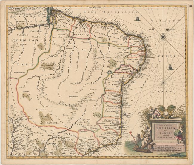
This scarce map is Johannes Blaeu's third map of Brazil. It includes the capitanias along the coast and is a significant improvement over Blaeu's previous maps of Brazil. The handsome cartouche is surrounded by cherubs and a river god. This map, designed by Joannes de Broen and engraved by Abraham Wolfgang, was completed shortly before the great fire that destroyed the printing house, and therefore was included in only one edition of Blaeu's atlases. In 1694 Pieter Schenk acquired a number of Blaeu's copperplates, including this one, however this example does not have Schenk's imprint and was therefore printed before 1694. Blank verso.
References: Van der Krogt (Vol. II) #9850:2C.
Condition: A
A fine impression in full contemporary color with faint offsetting and marginal toning. A short centerfold separation in the bottom blank margin has been closed on verso with archival materials.