Subject: Ecuador, Peru, & Colombia
Period: 1750 (circa)
Publication:
Color: Black & White
Size:
15.4 x 20.9 inches
39.1 x 53.1 cm
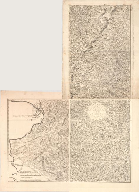
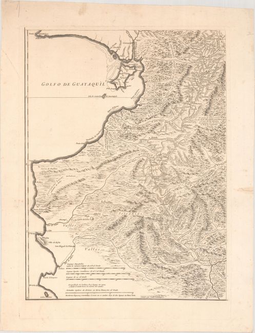
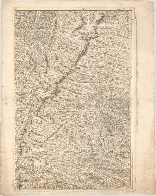
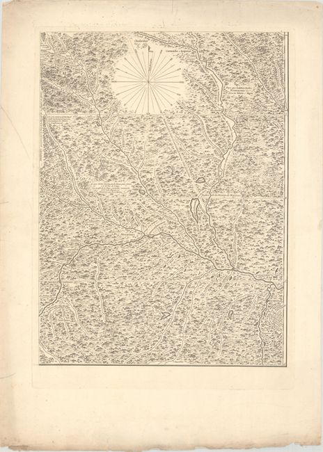
This lot includes the northeast, southeast, and southwest sheets of this very rare and historically significant map of the region. It is the work of Pedro Vincente Maldonado (1704-48), a Jesuit-educated physicist, mathematician, topographer, and geographer based in present-day Ecuador. From a young age, he began surveying the region, completing his first map around the age of 21. In 1736, he began to work with members of the Spanish-French Geodesic Mission, collaborating closely with Charles Marie de la Condamine. The Mission was one of the most important scientific expeditions in cartographic history. Its primary intention was to determine the precise length of a degree of longitude in the region of the equator in order to calculate the size and shape of the globe. The central area of this map was generally drawn from the Mission's precise surveys, while the outlying areas were based on Maldonado's intimate knowledge of the region.
Upon meeting with Maldonado in 1744, the court of Philip V approved the publication of his Ecuador map, breaking with the Spanish Crown's usual policy of secrecy regarding their colonial holdings. The map was to be published in Paris by Jean-Baptiste Bourguinon d'Anville. Maldonado collaborated closely with d’Anville and Condamine on preparing the proofs for the map, but died before its completion. In 1750, the Spanish ambassador to France requested all plates, pulls, and source materials related to the map in an attempt to prevent its publication. Condamine secretly engraved a second set of plates before surrendering the materials. Examples of the map are extremely rare because relatively few copies were produced; the copies that did exist were for private academic use, so as not to aggravate the Spanish Crown.
The sheets included here cover parts of Ecuador, Peru, and Colombia. Quito, Guayaquil, and Popayan are named. There is an incredible amount of topographical detail, showing mountains, volcanoes, rivers, rain forests, and more. Drawn by N. Guerard and engraved by Guillaume Delahaye. The top left sheet, featuring the title cartouche and northwestern Ecuador, is not included.
References:
Condition: B+
All three sheets are crisp impressions. The northeast sheet has a light damp stain that enters 1.5" into map image at top and scattered foxing that is mostly confined to the margins. The other two sheets have some minor spots and a few edge tears in the margins. There are two small worm holes on the southeast sheet. The first image is a composite image - the sheets are all separate.