Subject: South America
Period: 1744 (circa)
Publication: A Complete System of Geography
Color: Hand Color
Size:
16.7 x 13.9 inches
42.4 x 35.3 cm
Together, this lot of 4 copper-engraved maps covers the continent of South America. They are the work of Emanuel Bowen, one of the leading English mapmakers of the 18th century. Unusually he obtained royal appointments as engraver to both the French and English Royal Courts. Sizes vary slightly.
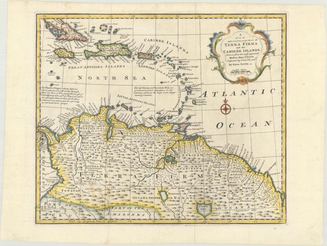
A. A New and Accurate Map of Terra Firma and the Caribbe Islands... This uncommon map shows most of the Caribbean from the southern part of Cuba through the Lesser Antilles and the northern part of South America to the Amazon Basin. It illustrates the region that was contested between the various European colonial powers and is filled with information on mines, cocoa plantations, native villages, and colonial settlements. One notation describes Wager's Action where an inferior British force defeated and destroyed the Spanish treasure fleet at Cartagena.
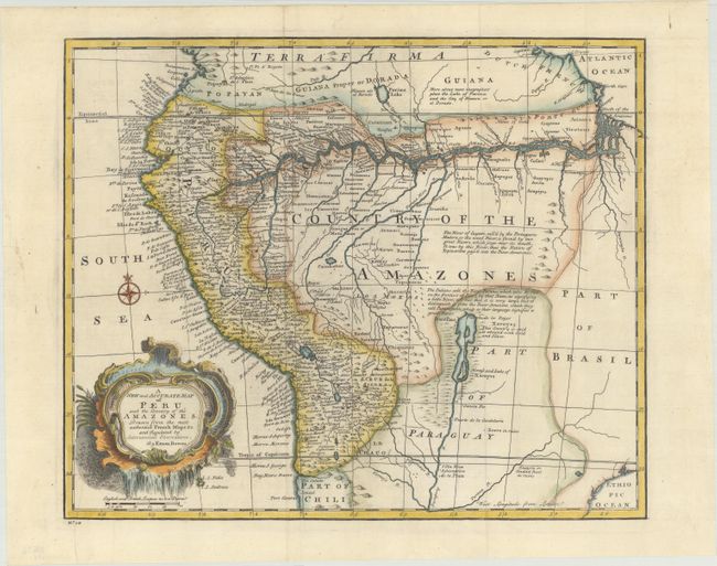
B. A New and Accurate Map of Peru and the Country of the Amazones... This handsome map is filled with detail of the west coast of South America and the Amazon River system. The map extends from Ecuador south well into Chili. The western coastal areas are fully developed and well mapped with hundreds of place names, including Quito, Lima, Cusco, and La Paz. There are several interesting notations including one locating gold and silver along the mythical Xarayes Lake. Another mythical lake, Parima Lake, is located in Guiana. The map is adorned with a decorative title cartouche.
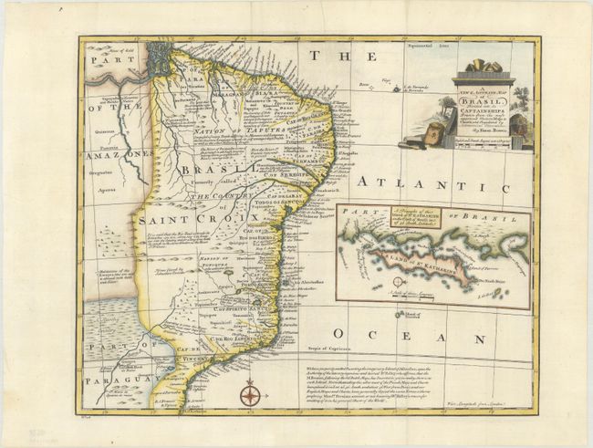
C. A New & Accurate Map of Brasil... This map features good detail along the coastal areas with scores of place names. The map covers the region between northern Paraguay and north to the mouth of the Amazon. A large inset of the Island of St. Katharine fills the blank ocean. In a lengthy note at bottom, Bowen states that he intentionally "omitted the imaginary Island of Ascension, upon the authority of Dr. Halley." The map includes several other notes, including an area said to "abound with Gold and Silver."
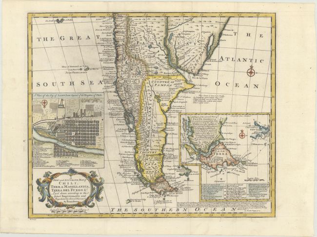
D. A New and Accurate Map of Chili, Terra Magellanica, Terra del Fuego &c... Finely engraved map of the southern part of South America, filled with place names, topographical detail, and many notations that provide additional geographical and historical information. An inset of a city plan for Santiago, capital of Chile, contains a legend listing significant buildings and locations. A second inset details the area around Terra del Fuego and traces the tracks of several explorations.
References: McCorkle (18th c. Geography Books) #17-22, 24, 25, & 26 (Vol II); cf. Shirley (BL Atlases) T.BOW-2a #52, 54, 55 ,& 56.
Condition: A
Crisp impressions on bright sheets issued folding, now flat, with some minor spots. The Peru sheet has a printer's crease at bottom left. Three of the four maps have remnants of hinge tape on verso.