Subject: Gulf of Mexico & Caribbean
Period: 1807 (dated)
Publication:
Color: Black & White
Size:
34.3 x 22.9 inches
87.1 x 58.2 cm
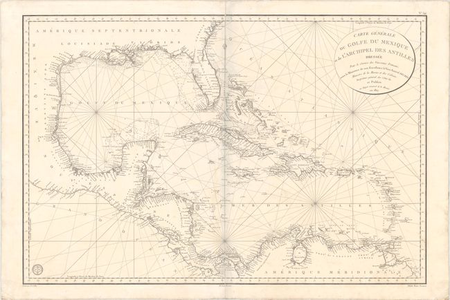
This scarce, large-scale chart covers the Gulf of Mexico, Central America, the West Indies and the north coastline of South America. Typical of nautical charts, the detail is confined to the coastline and includes place names, soundings, navigational hazards, banks, and shoals. This map was commissioned during the Napoleonic Wars when French efforts were focused mainly in Europe and French colonial possession were confined to a few islands in the Lesser Antilles and French Guiana. Engraved by E. Collin. Seal of the Depot de la Marine at bottom left and Prix Deux Francs below neatline at right.
References:
Condition: B+
A crisp impression on a bright, sturdy sheet with minor soiling and archivally repaired centerfold separations at top and bottom. There is a bluish shadow along the centerfold that is caused by our scanner and does not appear on the map itself.