Subject: Eastern Texas, Oil
Period: 1930 (circa)
Publication:
Color: Printed Color
Size:
21 x 33 inches
53.3 x 83.8 cm
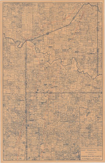
Printed with blue ink and published by the Standard Blue Print & Map Co., this detailed map shows land ownership and oil wells in Rusk County as well as parts of Smith, Gregg, Upshur and Harrison counties. This is a working example with the extent of the oil field traced in orange pencil and numerous oil wells and dry holes added in blue pencil. The first successful oil well was drilled in Rusk County in 1930. This map shows only a small number of the 1200 or so wells that were producing in Rusk County by the summer of 1931, so a date of 1930 or early 1931 is likely. Since 1930, the East Texas Oil Field is the largest U.S. oil field by volume and was vital to the Allied forces in World War II. OCLC shows the Standard Blue Print & Map Co. produced about 9 maps, but no examples of this map.
References:
Condition: B
Issued folding on beige paper with several short edge tears that have been repaired on verso with archival tape. There are several small fold separations along the vertical fold that also have been mostly closed on verso with archival tape. A working copy with manuscript additions to the map.