Subject: Woodstock, New York
Period: 1945 (circa)
Publication:
Color: Black & White
Size:
26 x 20 inches
66 x 50.8 cm
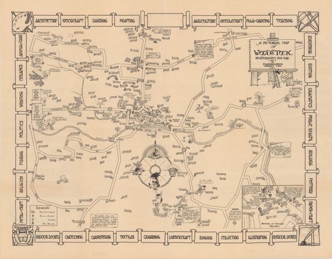
Designed and drawn by David Fairbanks, this rare cartoon map of Woodstock, New York captures the vibrant spirit of the artists colony. It serves virtually as a directory for the town at the time, with various properties identified by the owner's name. Among the notable residents identified are artist Paul Burlin, Ralph Radcliffe Whitehead, co-founder of the Byrdcliffe Arts and Crafts Colony, and Hervey White, a poet and utopian philosopher who helped found Byrdcliffe and later the Maverick. Roads are delineated, and Sawkill River is shown snaking through the center of town. A legend locates real estate agents, points of interest, churches, and well drillers. The map is sprinkled with charming illustrations, including a man on a unicycle, a golfer missing his shot by the Woodstock Country Club, a yodeler near the Alpine Inn, and a horse by the Maverick Concert Hall and Theater. Fairbanks is not above an easy pun: there are bears on the road to Bearsville and the residents of nearby Shady are under the protective cover of an umbrella. An inset at bottom right details the village square. The prominent compass rose indicates directions via racial caricatures. The map is surrounded by a decorative border highlighting activities in the area.
References:
Condition: A
Issued folding with a tiny edge tear confined to the left blank margin.