Subject: Baltimore, Maryland
Period: 1947 (circa)
Publication:
Color: Hand Color
Size:
52 x 41.6 inches
132.1 x 105.7 cm
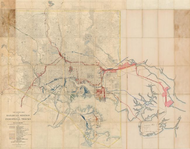
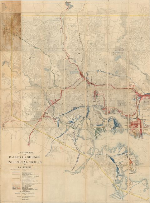
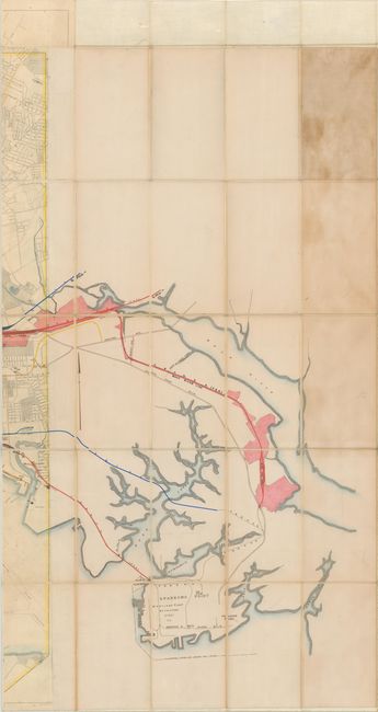
This large and unique map is based upon a 1940 Baltimore Association of Commerce railroad map and city plan of Baltimore. It has been extended to the east by the Chief Engineer's Office of the Pennsylvania Railroad, adding rail and water detail from Camp Holabird to Sparrow's Point (site of Bethlehem Steel) sometime in the late 1940s. The extended map provides a comprehensive view of the railroad network in the Baltimore area, with the Pennsylvania (red) and Baltimore & Ohio (blue) lines being the dominant players. Related manuscript notations label stations, tunnels, depots and yards, with the latter being concentrated most heavily along the waterfront. In addition to the transportation network, the map also presents excellent detail of the city showing the street grid pattern, parks, cemeteries, Canton Yards, Fort McHenry, and more. Dissected and laid down on linen. Self-folds into brown cloth wrappers.
The Pennsylvania Railroad was established in 1846 and by the 1880s had become the largest railroad (and corporation) in the world. It continued to prosper and grow by acquisition through the first half of the 20th century. The Pennsylvania Railroad merged with the New York Central in 1968, resulting in the Penn Central, but the combined company met its demise only two years later. The assets of the Pennsylvania Railroad are now owned by Amtrak and Norfolk Southern.
References:
Condition: B
Issued folding, dissected and backed with linen. There is overall light toning and soiling with moderate staining at far left and right due to the adhesive used to attach the cloth wrappers. Due to the size of the map, each half was scanned separately and the image was digitally merged. The map is in one piece and the images of each individual half are included as they are higher resolution than the digitally merged image.