Subject: Los Angeles, California
Period: 1924-52 (dated)
Publication:
Color: Printed Color
Two large geologic maps of the Los Angeles region including:
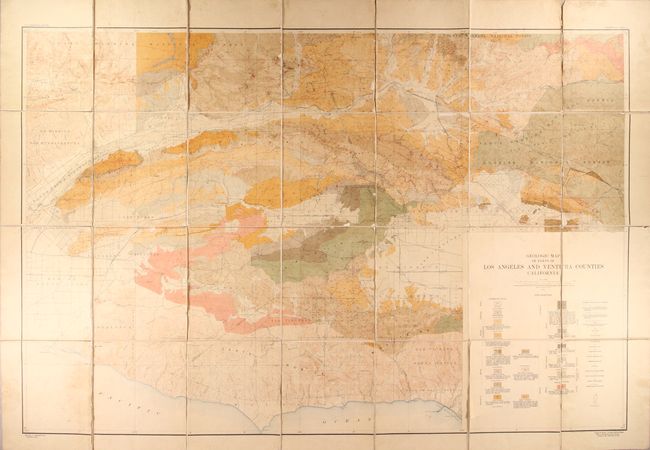
A. Geologic Map of Parts of Los Angeles and Ventura Counties California, dated 1924 (55.1 x 36.6"). A very large, colorful map based on the geology of William S.W. Kew, Carroll M. Wagner, Walter A. English and John P. Buwalda in 1917, 18, 19 and 22. The map uses color and pattern to delineate sedimentary and igneous rocks, geologic boundaries, axes, beds, oil wells, natural gas wells, derricks, brae deposits, and surface outcroppings of sand. The map is dissected and laid on linen. Condition: There is light soiling, staining, and some small chips and tears along the panel edges resulting in some very minor loss of image. (B+)
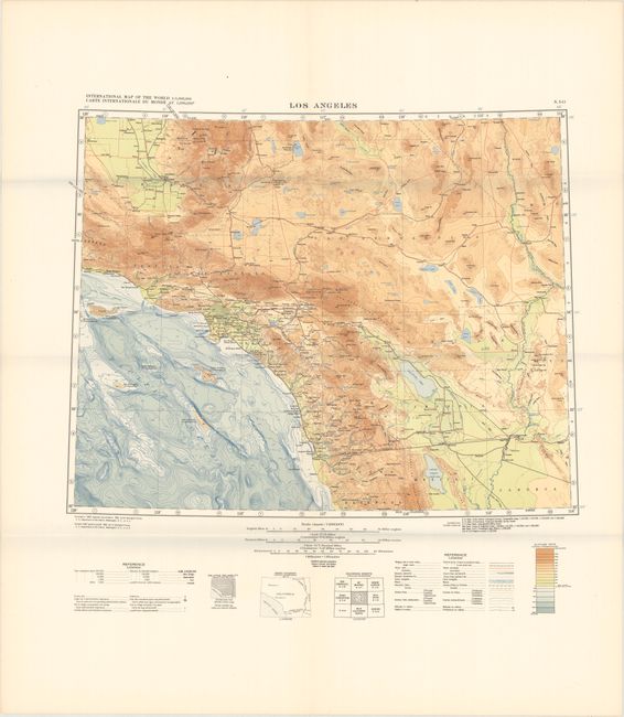
B. Los Angeles, dated 1952 (23.1 x 18.5"). This highly detailed map of Southern California shows the coast from Tijuana to Santa Barbara and inland to the Colorado River. It is unusual for presenting elevation on both land and sea using 18 altitude tints (based upon a combination of USGS and Coast Survey data). The map was one of the initial group of 14 maps in compliance with the projected International Map of the World, including some text in French. The international cooperation on the standard apparently was short-lived as subsequent maps of the series were prepared by the Army Map Service and did not conform to IMW specifications in all respects. Compiled in 1947, engraved and printed in 1952. Condition: Fine, issued folding. (A+)
References:
Condition:
See description above.