Subject: North America
Period: 1855 (circa)
Publication:
Color: Hand Color
Size:
14.8 x 11.5 inches
37.6 x 29.2 cm
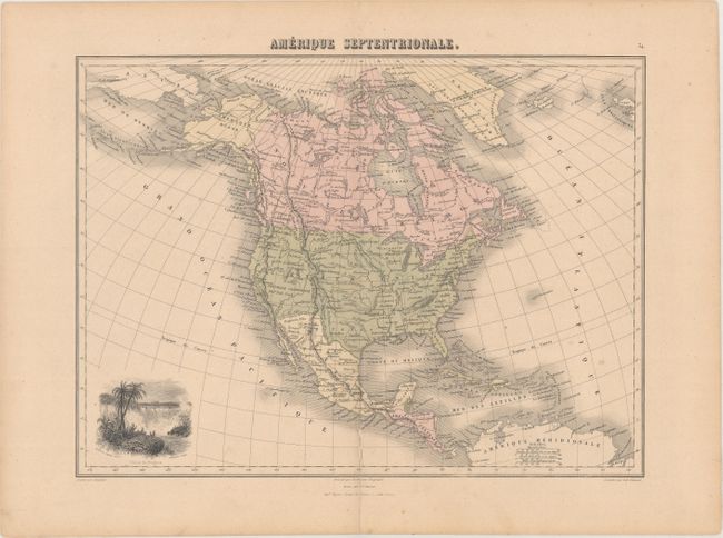
A nice map of the continent showing national boundaries, but not individual states and provinces. The United States is shown with its boundary with Canada completed, but the region is still marked Oregon ou Columbia, reflecting the recently settled dispute between Britain and the U.S. The boundary with Mexico is marked Limite d' apres le Traite de 1848. Alaska is Amerique Russe. Numerous Indian nations are located throughout. The most interesting feature of the map is the vignette (uncolored), Chute de Niagara. This unusual view of Niagara Falls, drawn by Frederic Legrip, features the great falls surrounded by what appear to be palm trees (!). Vignette engraved by Schroeder, map engraved by L.A. Sengteller.
References:
Condition: B+
Lightly toned with a centerfold separation that enters 1.5" into map at bottom that has been closed on verso with archival tape.