Subject: Eastern Asia
Period: 1732 (dated)
Publication: Nouvel Atlas de la Chine, de la Tartarie Chinoise, et du Thibet
Color: Hand Color
Size:
31.4 x 20.3 inches
79.8 x 51.6 cm
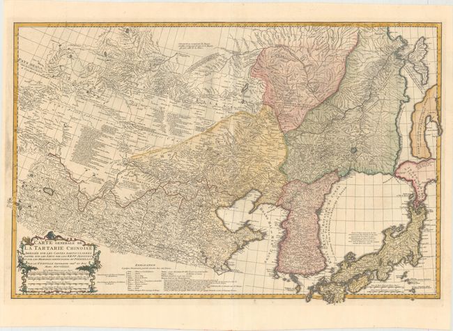
This superb, large map shows much of eastern Asia, including northern China, Korea, Japan, Mongolia, and the southeastern tip of present-day Russia. The map is densely engraved with cities, rivers, topography, political boundaries, and short notes. Honshu is well delineated, but Hokkaido (Jedso-Gasima) is very rudimentary with a note along the northern coast that there are reasons to surmise that the boundary in that area is limited. Another poorly defined landmass to the north includes a note that it was discovered by the Dutch and thought to be a continuation of Eso or Jeso, and yet another island further north is named Saghalien Anga Hata (present-day Sakhalin). Korea is labeled with several names, including Kaoli Koue (country of Goryeo), Royaume de Coree (Kingdom of Korea) and Tchao-Sien. A fascinating map filled with information, and adorned with a decorative title cartouche.
D'Anville assembled maps of China compiled from an extensive Jesuit survey carried out in 1708-16 for the Emperor Kang-Shi, which were published in Jean Baptiste du Halde's Description Geographique Historique... de l'Empire de la Chine et de la Tartarie Chinoise in 1735. It remained the principal cartographical authority on China during the rest of the 18th century. The missionaries used local sources and personal observation to prepare these incredibly detailed maps. The maps were then re-engraved by D'Anville for a Dutch market two years later and published in an atlas volume, Nouvel Atlas de la Chine, de la Tartarie Chinoise, et du Thibet.
References: Shirley (BL Atlases) T.HALD-3a #18.
Condition: A
A dark impression on a bright sheet, issued folding with light printer's ink residue and tiny holes at the fold intersections.