Subject: Asia, World War II
Period: 1944 (dated)
Publication:
Color: Printed Color
Size:
46 x 33.6 inches
116.8 x 85.3 cm
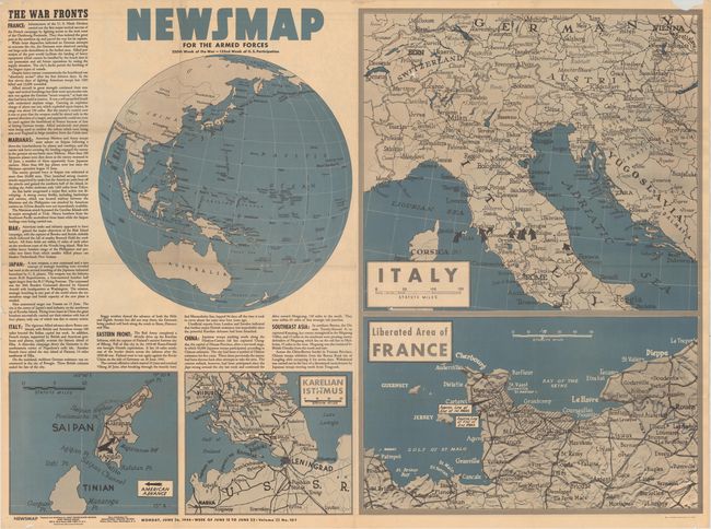
This "newsmap" was issued on Monday, June 26, 1944, and covers the news from June 15-22, 1944 - the 250th week of the war. This large sheet, measuring nearly 4 feet by 3 feet, includes five inset maps of the war situation including the Pacific theater, Saipan, "Karelian Isthmus", "Italy", and "Liberated Area of France."
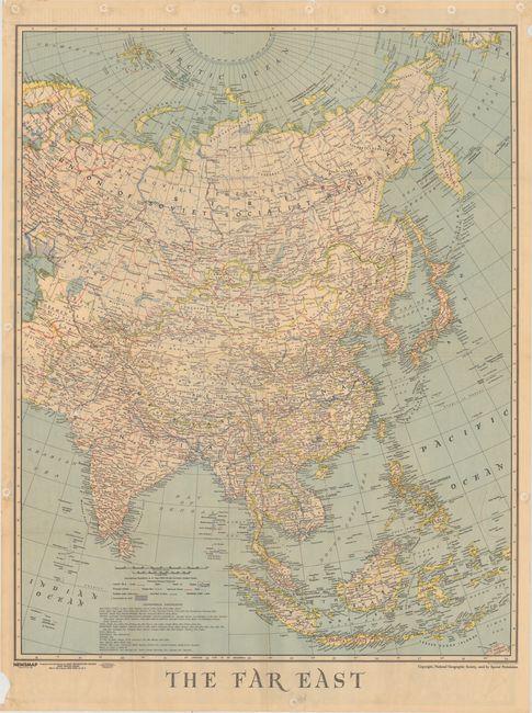
The verso contains a mammoth map entitled "The Far East," which covers the region from the Caspian Sea east to Japan and south to the East Indies. It is packed full with details including railroads, oil pipelines, roads, trails, canals, and more. Used with special permission from the National Geographic Society, prepared by the Army Information Branch, and issued by the U.S. Government Printing Office.
From 1942-46, the U.S. Army published "newsmaps" to keep American troops updated on the war. These weekly posters were distributed and posted in every American installation in the world and were intentionally more visual than descriptive to help engage and motivate personnel.
References:
Condition: B+
Issued folding with two small puncture holes (no image loss) and a few tiny splits at fold intersections. There are pinholes in the blank margins that have been strengthened with paper ring reinforcers on verso.