Subject: Western Hemisphere - America
Period: 1707 (circa)
Publication:
Color: Hand Color
Size:
8.9 x 5.9 inches
22.6 x 15 cm
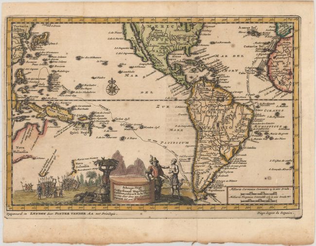
Charming map of the Americas and the Pacific Ocean with California as an island, although the northern tip extends off the map. The map was created to trace the route of Ferdinand Magellan's expedition to the East Indies from 1519 to 1522, which is shown on the map from Spain to the Moluccas. The map extends to include Australia, reflecting Dutch exploration in the area. Van Diemens is named both along the northern coast as well as in Tasmania. New Zealand and Quiri Regio are also partially outlined. In South America the mythical, equatorial Lake Parime is shown in Guyana with the golden city of Manoa on its western shore, and Lago de los Xarayes appears in the center of the continent. The cartouche features an encounter between Magellan and a native, with groups of European soldiers in the background.
References: McLaughlin #171.
Condition: A
A dark impression, issued folding with a hint of toning and soiling along the bottom edge of the sheet. Narrow left margin.