Catalog Archive
Auction 175, Lot 549

"Palestinae sive Totius Terrae Promissionis, Nova Descriptio", Magini, Giovanni Antonio
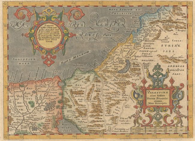
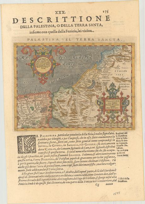
Subject: Holy Land

Period: 1598 (published)

Publication: Geografia cioe Descrittione Universale della Terra...

Color: Hand Color

Size:
6.8 x 4.9 inches
17.3 x 12.4 cm
Download High Resolution Image
(or just click on image to launch the Zoom viewer)

This miniature Holy Land map shows the region in rich detail. It stretches from the Nile Delta to Lebanon and focuses on the wandering of the Children of Israel, tracing the route of the Exodus. There are several place names and nice topographical detail. The map is adorned with two ornate cartouches. This example was published in an Italian edition of Ptolemy's Geographia that included 37 modern maps. Printed in Venice by Gio. Battista and Giorgio Galignani. On a sheet of Italian text measuring 7.7 x 11.2".

References: Mickwitz & Miekkavaara #226-59.

Condition: A+

Estimate: $220 - $250

Sold for: $160

Closed on 11/13/2019

Archived