Catalog Archive
Auction 175, Lot 538

"A New and Accurate Map of Anatolia or Asia Minor with Syria and Such Other Provinces of ther Turkish Empire as Border Thereupon...", Bowen, Emanuel

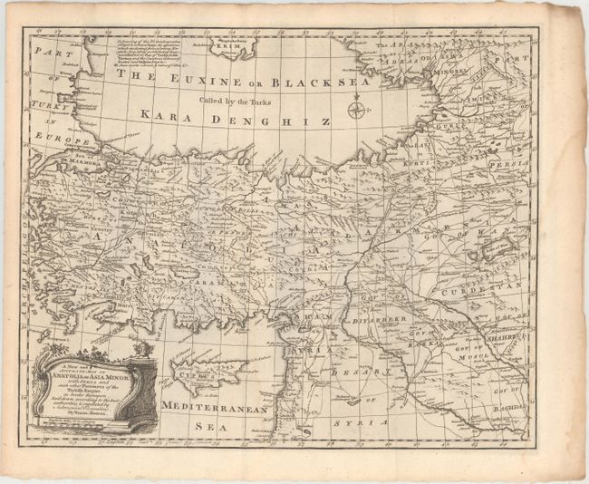
Subject: Eastern Mediterranean & Middle East, Black Sea

Period: 1766 (published)

Publication: The Maps and Charts to the Modern Part of the Universal History

Color: Black & White

Size:
16.6 x 13.5 inches
42.2 x 34.3 cm
Download High Resolution Image
(or just click on image to launch the Zoom viewer)

This richly detailed map centers on Turkey in Asia and extends to include much of the Black Sea, the eastern Mediterranean, Syria, Lebanon, and parts of Georgia, Armenia, and Iraq. Many towns and cities are named, including Istanbul (Constantinople), Aleppo, Damascus, and Baghdad. There is excellent topographical detail, and roads are delineated. Cyprus is depicted with place names and mountains. In the Black Sea, there is a compass rose capped with a fleur-de-lis. The title and distance scale are enclosed in a decorative cartouche at bottom left.

References: cf. Shirley (BL Atlases) T.BOW-2d #23.

Condition: B+

A dark impression issued folding with a couple light damp stains.

Estimate: $150 - $180

Sold for: $95

Closed on 11/13/2019

Archived