Subject: Southeastern Europe
Period: 1752-53 (published)
Publication: The Universal Traveller...
Color: Black & White
Size:
12.9 x 10.9 inches
32.8 x 27.7 cm
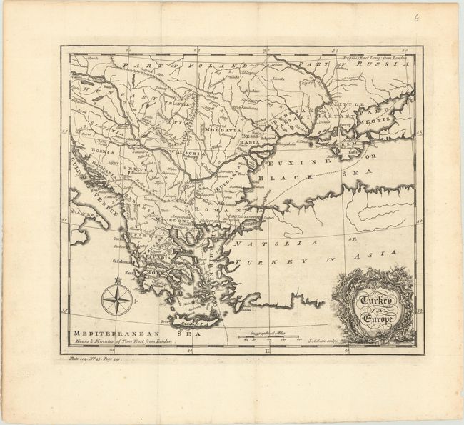
This handsome map shows Southeastern Europe from the Ionian Sea to the Black Sea. It identifies Slavonia, Bosnia, Dalmatia, Albania, Thessaly, Macedonia, Morea, Servia, Walachia, Moldavia, Bulgaria, Romania, and more. It names several cities, including Vienna, Buda, Belgrade, Bucharest, Athens, and Constantinople. The Danube is prominently shown along with other topographical information. The map extends into Asia, but those areas are left unengraved. There is a compass rose at bottom left and an ornate title cartouche at bottom right. Engraved by John Gibson.
References: McCorkle (18th C. Geography) #375-18; Shirley (BL Atlases) G.SALM-5a #13.
Condition: A
Issued folding with a fleur-de-lis watermark. There are a few minor spots at lower left.