Subject: Northeastern Spain
Period: 1647 (published)
Publication: Atlas Novus
Color: Hand Color
Size:
19 x 15 inches
48.3 x 38.1 cm
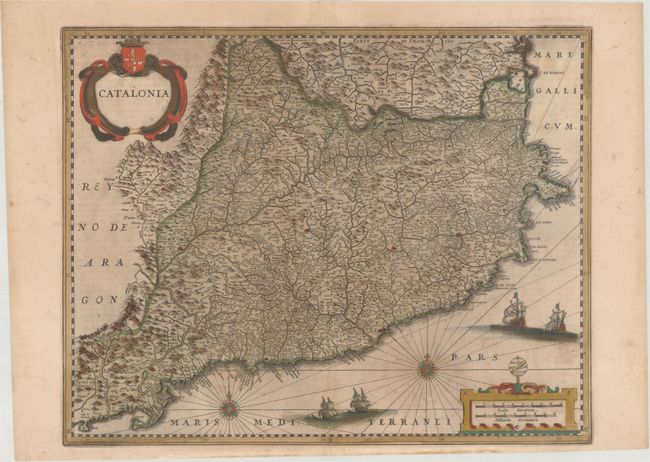
A handsome map of the Spanish region of Catalonia that covers the Mediterranean coastline from the French border via Barcelona to Tortosa. The map is filled with detail of topography, towns, and rivers. The map is adorned with two strapwork cartouches, a compass rose, and four galleons. Latin text on verso.
References: Van der Krogt (Vol. I) #6250:1B.
Condition: B
A nice impression with full contemporary color that has been partially refreshed and light color offsetting. There are archival repairs to two short cracks in the title cartouche and below the ships at bottom center. This map will ship flat.