Subject: Cartographic Puzzle, United States
Period: 1880 (circa)
Publication:
Color: Hand Color
Size:
17.9 x 11.5 inches
45.5 x 29.2 cm
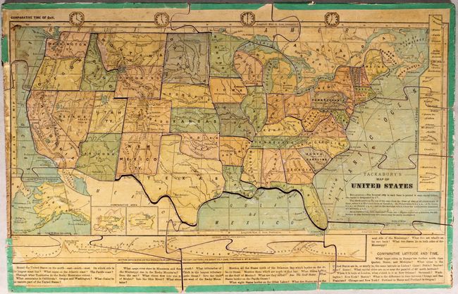
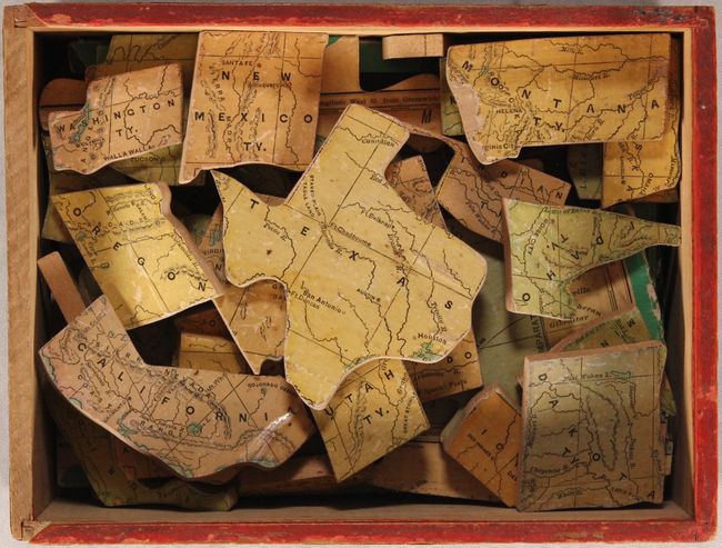
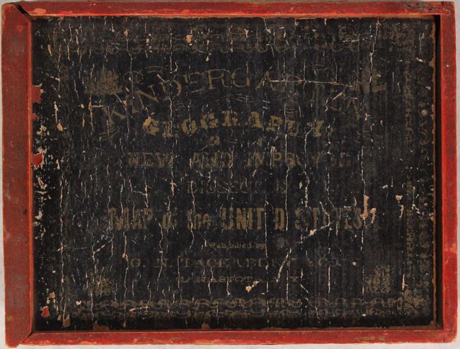
This complete, late 19th century puzzle contains 57 pieces with a single piece for every state/territory with the exception of Delaware and Rhode Island. Intended for younger children, the map presents basic details including each state's capital and largest city, topography, and the river systems. Includes an inset of Alaska and an elevation profile at bottom. The puzzle pieces are constructed of thick, 1/4" wood and are housed in a solid wood box with paper title label attached to the sliding top piece. Circa date is based upon a "testimonials" page pasted onto the inside of the box top.
References:
Condition: B+
The puzzle pieces have light soiling and a portion of the edge ribbon is missing mostly at left. The Montana piece is abraded at left with some small image loss. Box is sound and complete with moderate wear to the label on the box top and some loss of the decorative paper on the side panels.