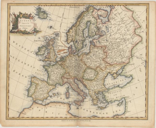
Subject: Europe
Period: 1783 (dated)
Publication: A Complete Course of Geography...
Color: Hand Color
Size:
16.5 x 13.6 inches
41.9 x 34.5 cm
An attractive map of the continent that extends north to the "Frozen Ocean" and south to the northern tip of Africa. The map is filled with fine detail including place names, river systems, and topography and also notes several fishing banks in the North Sea. Adorned by a decorative title cartouche at top left that indicates this is the second edition of the map. While the imprint below the map indicates 1783, the map was published in Gaultier's A Complete Course of Geography, by Means of Instructive Games... in 1795.
References: McCorkle (18th C. Geography Books) #115-2A.
Condition: A
On "W 1794" watermarked paper with light toning along the sheet edges.


