Subject: Europe
Period: 1741 (published)
Publication: Description Exacte de l'Univers, ou l'Ancienne Geographie Sacree et Profane
Color: Hand Color
Size:
18.5 x 13.9 inches
47 x 35.3 cm
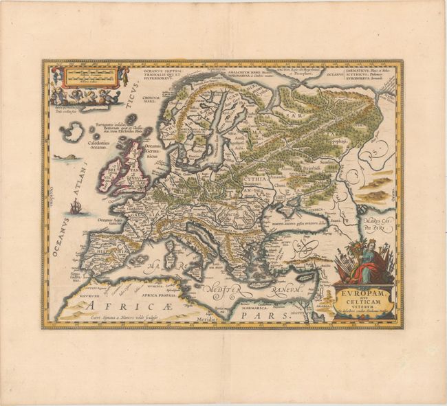
Splendid map of Europe in ancient times based on the Ortelius map of the same title. The title cartouche (which names Ortelius) is surmounted by a figure of Europa with flags, banners, and a cornucopia. Several little cherubs cavorting with sea creatures surround the distance cartouche. The land is fully engraved with forests, mountains and rivers, and there are several ancient place names. A beautiful example of fine Dutch cartography. Blank verso, published in Pieter de Hondt's Description Exacte de l'Univers, ou l'Ancienne Geographie Sacree et Profane, a French edition of Georgius Hornius' Accuratissima Orbis Antiqui Delineatio, which included maps from Johannes Jansson's historical atlas and Abraham Ortelius' Parergon.
References: Van der Krogt (Vol. I) #1000H:1A.
Condition: A
A nice impression on a bright sheet with wide margins and is minor offsetting.