Subject: Brazil
Period: 1730 (circa)
Publication:
Color: Hand Color
Size:
21.6 x 19.3 inches
54.9 x 49 cm
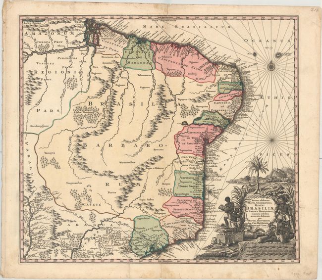
This striking map depicts Brazil from the Amazon delta to Sao Paolo and inland to the Rio de la Plata olim Paraguay. The Amazon delta contains many small islands and a confusion of waterways. The coastline is well mapped, divided into captaincies with the location of many place names; the interior, however, is largely unexplored. The bold figural title cartouche features the scenery, natives, and agricultural bounty of the region.
References:
Condition: B+
A dark impression with full contemporary color on watermarked paper, a printer's crease at bottom, and minor scattered foxing that is especially concentrated along the centerfold at top. There are two short horizontal splits across the centerfold and short centerfold separations at top and bottom.