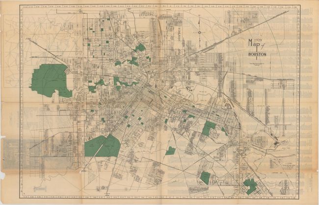
Subject: Houston, Texas
Period: 1929 (dated)
Publication:
Color: Printed Color
Size:
29.8 x 20.8 inches
75.7 x 52.8 cm
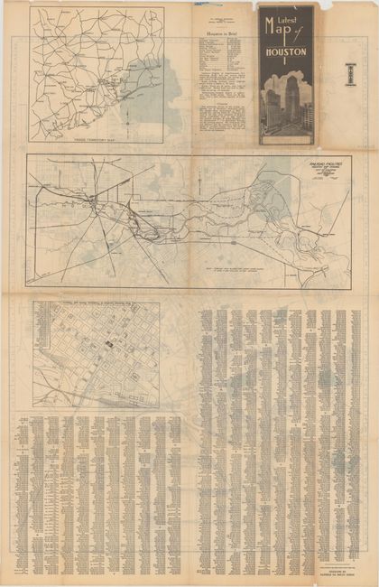
A detailed street map of Houston published by the Texas Blue Print & Supply Co. Locates main travel arteries, street car lines, city bus lines, parks, country clubs, the Rice Institute, and more. The verso contains maps of the prominent hotels and theaters, the Houston Ship Canal, and the trade territory around Houston. Self-folding into pictorial wrappers with title "Latest Map of Houston" showing early high-rise buildings. No auction records or dealer listings in the last 30 years and only one institutional copy located on OCLC.
References:
Condition: B
Issued folding on thin paper with light toning and light to moderate show-through from text on verso. There are several tiny holes along the fold lines, resulting in minute loss of image.