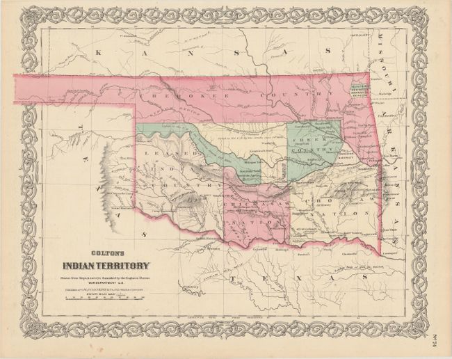
Subject: Oklahoma
Period: 1869 (published)
Publication: Colton's General Atlas
Color: Hand Color
Size:
16 x 12.9 inches
40.6 x 32.8 cm
This is one of the earliest, if not the earliest, map of Indian Territory to be included in a commercial atlas (see Rumsey reference). It is also one of the first maps to show the final boundary configuration for what would become the state of Oklahoma. The map reflects the status of lands allocated to various Indian tribes including large holdings for the Cherokee, Creek, Choctaw, and Chickasaw tribes. Includes large areas "ceded to the U.S." by the Seminole and Creek Indians, and a large area in the southwest is marked "Leased Indian Country." In 1817 the U.S. government began to relocate the principal eastern Indian tribes from their traditional home lands to Indian Territory where the Five Civilized Tribes formed the nucleus of an organized government. By the 1870s there were more that twenty-five tribes settled on lands once promised to the original five. The attractive map is surrounded by Colton's signature strapwork border. The verso contains the left side of a double-page map of Nebraska.
References: Rumsey #0152.060.
Condition: A
A few minor spots confined to the margins.