Subject: Ohio
Period: 1812 (circa)
Publication: A New and Elegant General Atlas
Color: Black & White
Size:
7.9 x 9.8 inches
20.1 x 24.9 cm
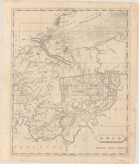
This important early map of Ohio depicts the large land divisions made by Congress shortly after gaining statehood. The state is divided into Indian Lands, Army Lands, Seven Ranges, Virginia Donation Lands, and a French grant. Numerous forts, settlements, battlefields, rivers, portages, and early roads are depicted throughout. The notation Major Truman killed appears in the northwest, depicting the location where Captain Alexander Trueman was killed by Indians while on a peace mission in 1792. This map was first published in 1804 and was the first published map of Ohio after gaining statehood. This is the second state with the names of Lewis and the engraver, Alexander Lawson, erased.
References:
Condition: A
Minor foxing mostly confined to the blank margins, with a couple of small chips along the edges of the sheet