Subject: Michigan
Period: 1847 (circa)
Publication:
Color: Hand Color
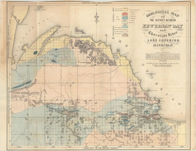
A. Geological Map of the District Between Keweenaw Bay and Chocolate River. Lake Superior Michigan, by Foster/Whitney (24.3 x 19.6"). This detailed geological map covers the region from the Keweenaw Bay to the Chocolate River. A color-coded key locates seven geological types, including sandstone, quartz, limestone, schistose and trappean rocks, granite and basalt. There is also good detail of relief shown in hachure. A scale below the title converts chains to miles. Fancy title lettering. Marcou & Marcou #369. Condition: Light offsetting and trimmed margins at top and bottom. (B)
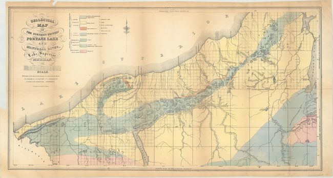
B. Geological Map of the District Between Portage Lake and Montreal River, Lake Superior, Michigan, by Foster/Whitney (29.6 x 15.5"). Covers the area from the Michigan/Wisconsin border to Keweenaw Bay with a color-coded key locating seven geological types. Locates both a Catholic and Methodist mission along Keweenaw Bay with several trails extending into the unsurveyed interior. Condition: Light toning. (B+)
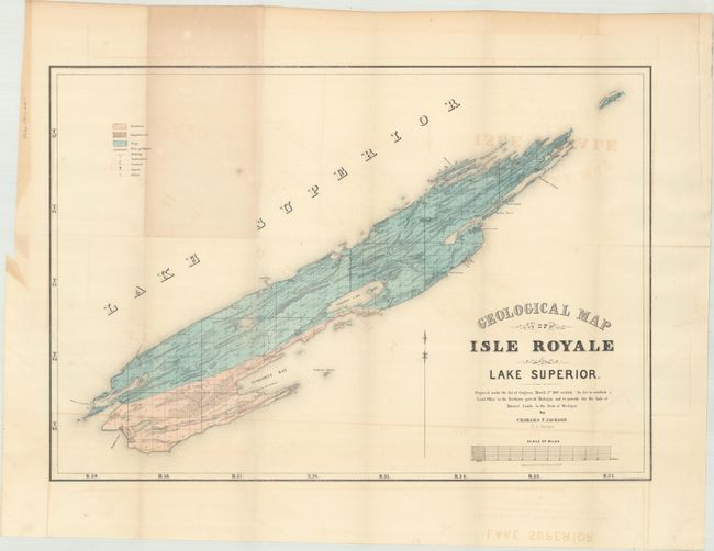
C. Geological Map of Isle Royale Lake Superior, by Charles T. Jackson (21.3 x 14.8"). This is an early edition of Jackson's important geological map that locates sandstone, conglomerate and trap formations and delineates copper veins as well as copper and silver mines. A scale below title converts chains to miles. Fancy title lettering. Condition: Light offsetting. (B+)
References:
Condition:
Issued folding. See description above.