Subject: Arizona
Period: 1903-09 (dated)
Publication:
Color: Printed Color
Size:
16.9 x 20.5 inches
42.9 x 52.1 cm
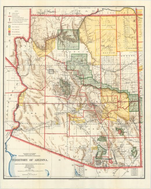
A. Territory of Arizona, dated 1903. This colorful and fascinating map presents great detail of the territory just nine years before statehood. The extent of nine Indian reservations and at least four military reservations, including Fort Apache, are clearly shown in different colors. Private claims, confirmed and unconfirmed, are outlined in red. The Grand Canyon Forest Reserve is shown. Brown hachured mountainous areas and the blue waterways combine to provide great visual impact. Details include watershed, mountains, railroads, wagon roads, private claims, unsurveyed townships, etc. This is the first map to name Sedona, here called Sedonia.
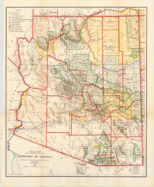
B. Territory of Arizona, dated 1908. An updated map from above, four years before statehood. The map clearly shows Indian Reservations, military Reservations (Fort Apache, Fort Grant, Fort Huachuca, and Fort Whipple), and National Forests via different colors. Also includes the new categories of National Monuments and National Game Preserves. The new Petrified Forest National Monument (established in 1906) is located east of Holbrook.
C. Territory of Arizona, dated 1909. An updated map from above, three years before statehood. In addition to the Indian Reservations, military reservations, and national forests, there is good detail of the evolving railroad network and state of public surveying.
References:
Condition: A
Issued folding.