Subject: Central United States
Period: 1818 (dated)
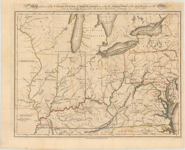
Publication: Notes on a Journey in America...
Color: Hand Color
Size:
15.9 x 12 inches
40.4 x 30.5 cm
This map was published in an account of Morris Birkbeck's emigration to the United States and his experience traveling from Virginia to Illinois Territory. In the work, he writes about his intent to establish a wilderness sanctuary, which appealed to many middle-class Europeans, and went through multiple editions. The text includes a map covering the region from Virginia to the lower Great Lakes, including the new state of Indiana as well as Illinois and Northwest Territories. It depicts Birkbeck's journey from the Northern Neck of Virginia to Washington DC, Pittsburgh, Cincinnati, and finally Princeton, Indiana. Of cartographic interest, it shows Illinois approximately 50 miles too far to the west of Lake Michigan, with Indiana completely surrounding the southern part of the lake. Also shows the river system and numerous forts, towns and villages. Engraved by Neele & Son.
References: Howes #B-468.
Condition: B
Issued folding with contemporary outline color on paper with an "1810" watermark. There is light toning and offsetting, and archival repairs to several separations along the folds.