Subject: Geography Books
Period: 1596 (published)
Publication:
Color: Black & White
Size:
5.4 x 7.7 inches
13.7 x 19.6 cm
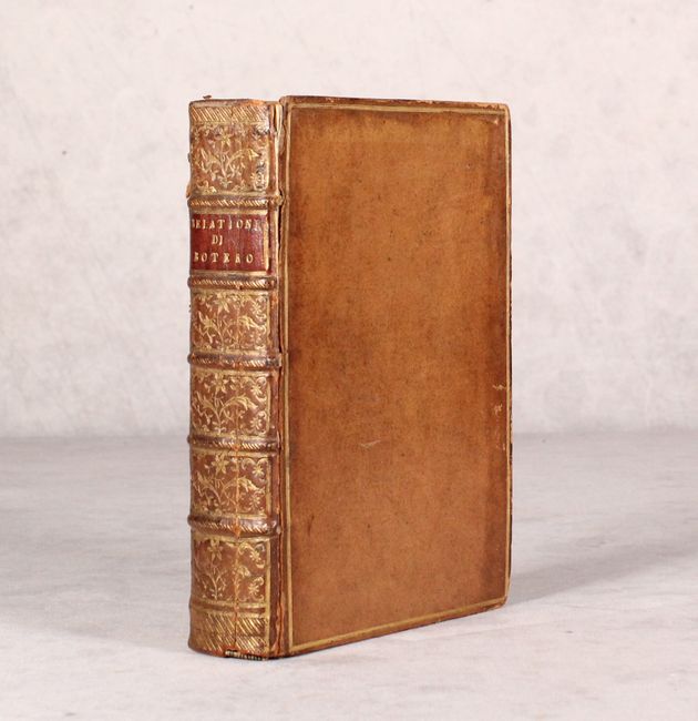
This is Botero's popular work, Relationi Universali with four parts in one volume. Botero, the Secretary to the Duke of Savoy, created this political and geographical description of the different countries around the world, accompanied by four maps of the continents. This volume is missing the title page to Part One (Parte Primo), but otherwise appears to be complete. 12mo., hardbound in full leather with raised bands, gilt tooling, and red title label on spine. The maps are:
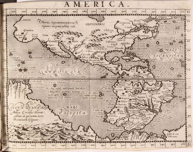
A. America. This early map of the Americas is based on Ortelius and D'Anian. The Sierra Nevadas are named Quivira and appear both as a region and a large city in North America. The towns of Marta, Zalisco and Culuacan are noted near present-day New Mexico. Another large city labeled Totonteac is shown at the top of the Mar Vermeio (Gulf of California). A wide St. Lawrence River has its headwaters in a tiny lake in the region named Saguenai, and there are no Great Lakes. The names Norinbega for New England, Mocosa and Apalche are on the eastern seaboard. Off the coast, the imaginary islands of Frislant, Dos Demonios, Sept Cites and St. Brendain are shown. South America is shown with a bulging western coast from Ortelius, while an outsized La Plata River plunges into the continent. A massive Tierra del Fuego fills the bottom of the map and is connected to an even more massive Nova Guinea, which carries a notation referring to Andrea Corsali, a 15th century Florentine explorer who described and named the Southern Cross. References: Burden #86. Condition: An excellent impression, trimmed at right with loss of the neatline. (B+)
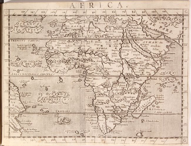
B. Africa. This uncommon map shows the entire continent of Africa surrounded by stippled seas in the typical Italian style. The rivers of central and northern Africa feature prominently including the Ptolemaic concept of the origin of the Nile in two lakes south of the Equator. The largest of these lakes also has a river flowing southeast. As is seen in many maps from this period, Zanzibar is incorrectly located on the west coast. The map is filled with city names, although Monomotapa and Vigiti Magna are noticeably missing. Decorated by a menacing-looking sea monster in the south Atlantic Ocean. References: Betz #32; Norwich #22. Condition: An overall nice impression that is weak at bottom right, and a couple of small spots. (B+)
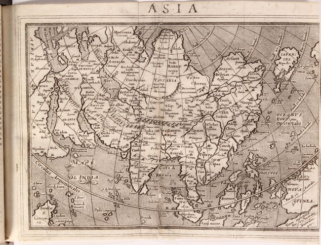
C. Asia. This is an attractive copper engraved map based on Ortelius and Gastaldi. Japan appears as a huge island in the kite-shape popularized by Ortelius. Another prominent feature is the large New Guinea in the lower right corner of the map, which is separated from Terre incognitae Par Australis by a narrow straight. Engraved by Porro. References: Yeo #16. Condition: A crisp impression with archival repairs to some separations and tiny holes along one of the folds, with minor loss of image. Trimmed at right with partial loss of border. (B)
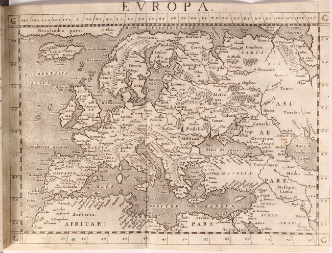
D. Europa. This map of the continent focuses on key regions, a few cities, rivers, and mountain ranges. Greenland extends along the top of the map at left and includes the city of S. Thome. Condition: A nice impression with a few faint stains and trimmed at right with loss of neatline. (B+)
References:
Condition: B+
See description for details on each of the maps. The text has occasional light soiling and minor toning. The title pages to Parts 2-4 have archival repairs to some tears and chips. The hinges are starting, the covers are lightly worn with bumped corners, and the spine has a few cracks.