Subject: Persian Gulf
Period: 1600 (published)
Publication: Thresor de Chartes
Color: Hand Color
Size:
4.9 x 3.4 inches
12.4 x 8.6 cm
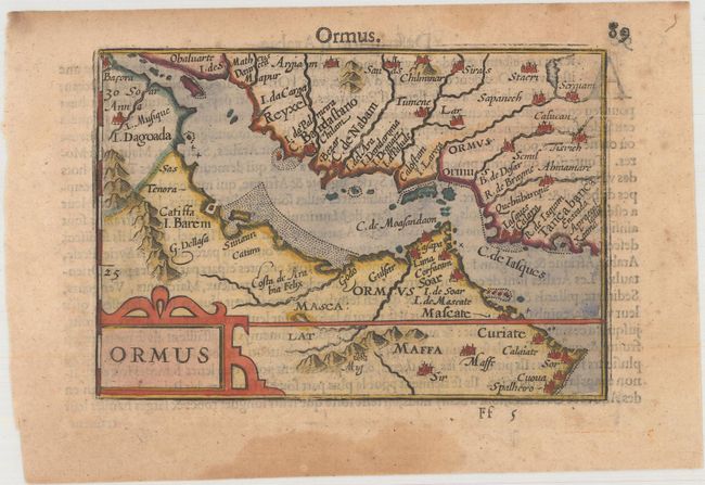
This miniature map is centered on the Persian Gulf, depicting portions of Arabia and Persia. The focus of the map is the Kingdom of Ormus, which existed between the 10th and 17th centuries. Tiny towns, rivers, and mountains are depicted, along with a simple strapwork title cartouche. French text on verso.
The map was first published by Cornelius Claesz and printed by Barent Langenes in the 1598 edition of the popular Map-treasury. For the 1599 edition, graduation lines and latitude numerals were added to one side of the border on most of the maps, which were again used for multiple editions through 1650. This is the second state with the added graduation lines from a French edition, printed by Albert Hendricks.
References: Ankary #30; King (2nd ed.) p. 80-82; Van der Krogt (Vol. III) #1210:341.
Condition: A
Minor toning with damp stains confined to the blank margins.