Catalog Archive
Auction 174, Lot 630

"Insula Creta Hodie Candia in sua IV. Territoria Divisa cum Adjacentibus Aegei Maris Insulis...", Homann, Johann Baptist
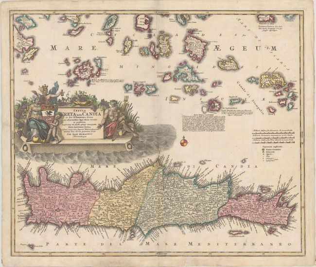
Subject: Crete

Period: 1730 (circa)

Publication: Neuer Atlas Bestehend...

Color: Hand Color

Size:
22.6 x 19 inches
57.4 x 48.3 cm
Download High Resolution Image
(or just click on image to launch the Zoom viewer)

This is a handsome, decorative map of Crete and the Aegean Islands as far as Ydra and Patmos. It includes the Cyclades and the beautiful island of Santorini with a lengthy Latin note about the early volcanic activity that changed Santorini's shape. The map is adorned with a beautifully engraved cartouche featuring a figure of Neptune, Mercury, an Ottoman ruler, cherubs and a veritable vineyard of grapes.

References:

Condition: B+

A nice impression on watermarked paper with light soiling and several edge tears that enter the border and have been archivally repaired on verso.

Estimate: $325 - $400

Sold for: $175

Closed on 9/11/2019

Archived