Subject: Cartographic Game, Americas
Period: 1850 (circa)
Publication:
Color: Hand Color
Size:
23.3 x 25.8 inches
59.2 x 65.5 cm
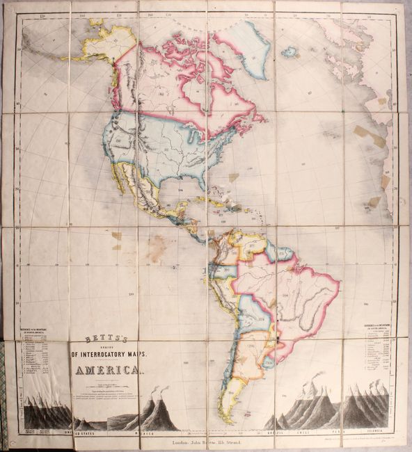
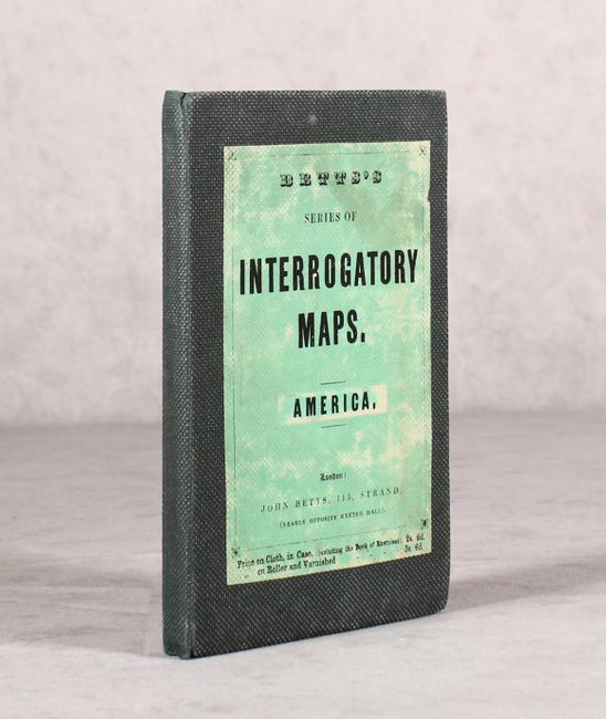
This very rare folding pocket map was used to teach geography and test students, therefore it has no place names. Instead, the map uses a series of numbers to represent cities, countries, mountain ranges and bodies of water. The geography of this map shows the Mexican-U.S. border pre-Gadsden Purchase. Also featured on the map are two tables comparing the heights of some of the highest mountains on each continent. This example is dissected into 24 parts, backed with linen and folded into cloth covered boards that measure 4.5 x 7.3". A fine example of a geographical teaching tool used in the mid-19th Century.
References:
Condition: B
There is a stain in blank area near the center, a few small abrasions, and several tape remnants on the face of the map. These appear to be the type of tape used to mount stamps. The map has a crisp impression with vibrant original hand color. Linen and boards are sound