Subject: Canal du Midi, France
Period: 1693 (circa)
Publication:
Color: Black & White
Size:
23.6 x 17.7 inches
59.9 x 45 cm
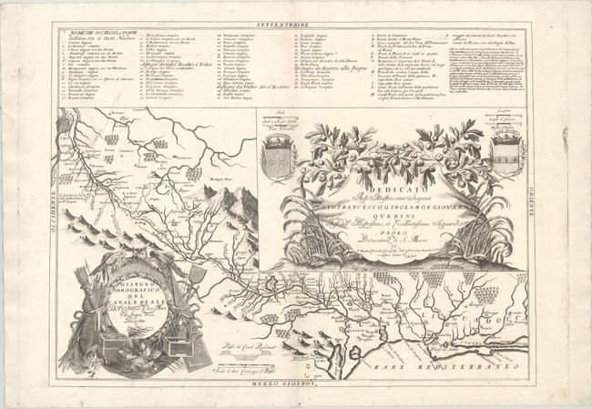
This beautifully engraved chart delineates the course of the man-made Canal du Midi, considered one of the crowning construction works of its era. Completed in 1681, the Canal du Midi links with the Canal de Garonne to connect the Atlantic and the Mediterranean. It spans from Toulouse to the Etang de Thau. Mountains and forests are depicted graphically. There is a profile view of the canal just above the distance scale. A key at top identifies locations along and around the canal. Two coats of arms and an ornate dedicatory cartouche fill a large inset. The decorative title cartouche at bottom left includes an owl, a quiver full of arrows, fishing nets, crates, and more. The map was first published in 1693 in Coronelli's Corso Geografico Universale and appeared in other subsequent collections and publications.
References: cf. Shirley (BL Atlases) T.CORO-8a #41.
Condition: A
A crisp impression on a sturdy sheet with some light printer's ink residue.