Catalog Archive
Auction 174, Lot 303

"Carte Reduite des Debouquements de St. Domingue, Levee, Dressee et Publiee par Ordre du Roi...", Chastenet-Puisegur, Jacques, Comte de

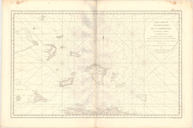
Subject: Northern Hispaniola & Southern Bahamas

Period: 1787 (dated)

Publication: Le Pilote de l'Isle de Saint-Domingue

Color: Black & White

Size:
36 x 22.5 inches
91.4 x 57.2 cm
Download High Resolution Image
(or just click on image to launch the Zoom viewer)

This large-scale chart depicts the lower Bahamas, including the Turks & Caicos Islands, and the northern shore of Hispaniola. There is excellent detail of towns and villages, soundings and anchorages, shoals and topography. The engraved seal of the Depot de la Marine appears within Cuba, and the price is below the neatline at right: Prix Trois Francs.

References:

Condition: A

A bright sheet with faint toning along the centerfold and damp stains confined to the top corners of the sheet, well away from the image. There are some grayish shadows along the centerfold that are caused by our scanner and do not appear on the chart itself.

Estimate: $275 - $350

Sold for: $200

Closed on 9/11/2019

Archived