Catalog Archive
Auction 174, Lot 256

Texas Oil Map with Accompanying Lease

"Geological Map of Texas [with] [Gillespie County Oil and Gas Lease]",
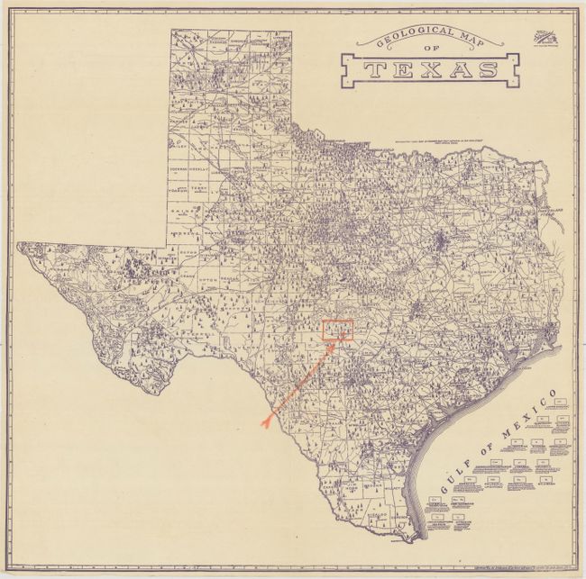
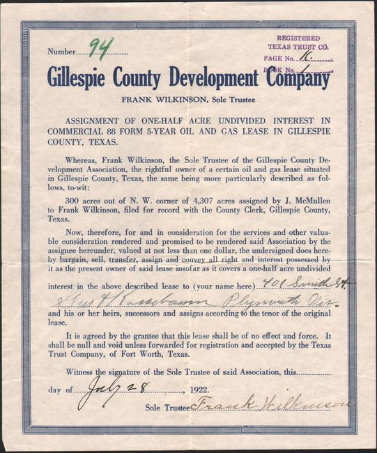
Subject: Texas, Oil

Period: 1920 (dated)

Publication:

Color: Printed Color

Size:
18 x 17.8 inches
45.7 x 45.2 cm
Download High Resolution Image
(or just click on image to launch the Zoom viewer)

This scarce pocket map, printed in blue ink, focuses on the burgeoning oil and gas business in Texas. It locates numerous oil wells and oil fields in the state, and presents seventeen geological structures that are keyed to the map. A manuscript arrow has been drawn in pointing to a location in Gillespie County, which corresponds to an accompanying deed for an oil lease dated July,1922 (see images). Issued by the Standard, Blue Print, Map & Engineering Company, 515 Main Street, Fort Worth. No examples were located for this uncolored version on OCLC or elsewhere. Click here for a similar, colored version of the map.

Although oil was known to exist in Texas as early as 1543, the oil boom in Texas and Oklahoma began in earnest in the early part of the 20th century.

References:

Condition: A

A nice example, issued folding.

Estimate: $300 - $400

Sold for: $475

Closed on 9/11/2019

Archived