Catalog Archive
Auction 174, Lot 223

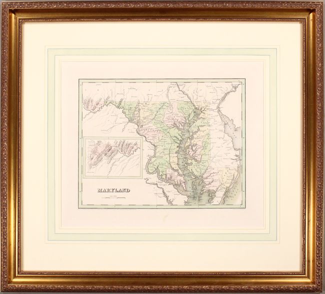
"Maryland", Bradford, Thomas Gamaliel
Subject: Maryland

Period: 1838 (dated)

Publication: An Illustrated Atlas Geographical Statistical and Historical of the United States

Color: Hand Color

Size:
14.3 x 11.2 inches
36.3 x 28.4 cm
Download High Resolution Image
(or just click on image to launch the Zoom viewer)

This county map of Maryland includes an inset of the far western tip of the state. Early roads and railroads are shown throughout the map, extending into neighboring states. Published shortly after the establishment of Carroll county. Engraved by G. W. Boynton.

References:

Condition: A

Lovely contemporary color on a bright sheet with minor marginal soiling. Framed with archival materials. Not examined outside of frame - sold as is and not subject to return.

Estimate: $160 - $190

Sold for: $120

Closed on 9/11/2019

Archived